How to find us
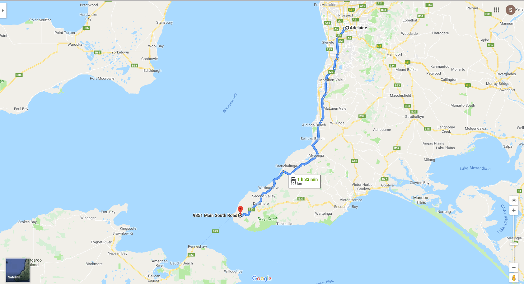
Cape Jervis Accommodation and Caravan Park is at 9351 Main South Rd Cape Jervis and is 105 kms or about 1 hour and 45 mins south of Adelaide, we are situated at the base of the hill on the left as you descend into Cape Jervis. We are an ideal base to explore the Southern Fleurieu Peninsula.
From Adelaide:
Driving from Adelaide take the Southern Express Way that brings you to the start of the enchanting McLaren Vale wine region, you then climb Sellicks Hill and the Victory Hotel, a good spot for lunch if needed.
Wind your way through the townships of Myponga with its micro-brewery, Yankalilla, Normanville – (both have lovely bakeries) or if you need a breath stop at the HMAS Hobart lookout, and admire the beautiful coastal views before passing through Second Valley and the Old Mill, then it’s on through Delamere , a handy place to refuel before crossing to the island. As you start your descent to Cape Jervis admire the breathtaking views of the Island but slowdown for our entry at the base of this hill.
From Victoria, or the South East
For those from this direction make you way to Strathalbyn it is 108km, or, approx. 1hour and 30min this way. Make your way towards Victor Harbor. From Victor Harbor take Range Road past Waitpinga, Willow Creek and Parawa, through the tall pine forests and Deep Creek Conservation Park, then it’s on through Delamere, a handy place to refuel before crossing to the island. As you start your descent to Cape Jervis admire the breathtaking views of the Island but slowdown for our entry at the base of this hill.
Fleurieu Peninsula Map Showing Adelaide to Cape Jervis and Kangaroo Island

Maps & Brochures
Wanting to do some exploring?
To help you plan we have included some maps a variety of maps and lists that you can download.
They give detailed information on Deep Creek Conservation Park, the key walks graded by difficulty and estimated time required as well as other information on specific areas, plants and bushwalking tips.
Deep Creek Conservation Park brochure
Deep Creek Conservation Park map
Deep Creek flora species – alphabetical
Deep Creek flora species – family
Park maps
- Deep Creek Conservation Park map
- Deep Creek Conservation Park – Cobbler Hill and Eagle Waterhole map
- Deep Creek Conservation Park – Stringybark map
- Deep Creek Conservation Park – Trig and Tapanappa map
- Deep Creek Conservation Park – TrailRider Wheelchair suggested routes map
The TrailRider all-terrain wheelchair allows people with limited mobility to explore the diverse trails. The one-wheeled chair is a cross between a wheelbarrow and sedan chair. The TrailRider requires a minimum of two reasonably fit people (one at each end of the chair).
The TrailRider can be used on a number of different walking tracks and in a variety of locations, including the stunning Deep Creek Conservation Park. You will need two or four fit helpers, depending on the trails you wish to travel and the strength and level of fitness of your helpers. The chair is motorised, making it easier to explore some steeper and longer trails.
TrailRider all-terrain wheelchair hire
The District Council of Yankalilla have a TrailRider wheelchair available for free hire for up to three days. Chair users are required to bring a bike helmet and undertake a chair induction via short video prior to use. It weighs 25kg, but can easily disassemble and fit in the back of most medium sized SUVs.
Bookings are essential to avoid disappointment.
To book, contact:
Fleurieu Coast Visitor Information Centre
163 Main South Road, Yankalilla SA 5203
Phone: 08 8558 0240 or 1300 965 842
Email: cooee@visitfleurieucoast.com.au

